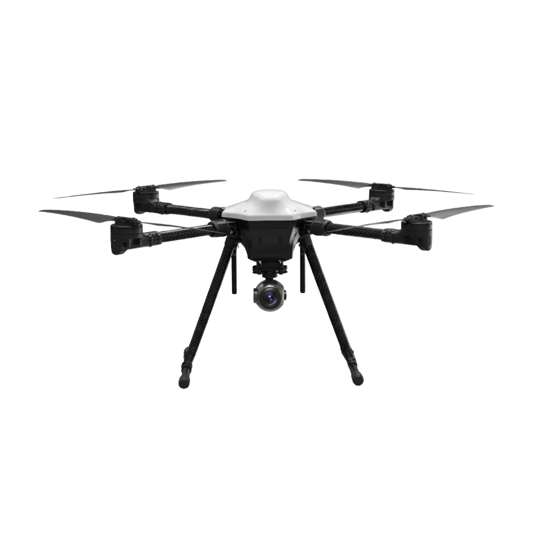
Precision Inspection and Mapping Drone
Centimeter-accurate industrial inspection with triple RGB, thermal and LiDAR sensors.
Ref. LNK-Drone d'Inspection de Précision et Cartographie
Description of Drone d'Inspection de Précision et Cartographie
The Lannkin Drone d'Inspection de Précision et Cartographie represents the culmination of several years of research and development in the field of drone-based industrial inspection. Designed to meet the most stringent requirements of the construction, energy, telecommunications, and critical infrastructure sectors, this multirotor drone carries a next-generation sensor suite that is revolutionizing how professionals conduct inspection, mapping, and topographic surveying missions.
At the heart of the Drone d'Inspection de Précision et Cartographie lies an integrated triple sensor system, combining a 48-megapixel high-resolution RGB camera, a radiometric thermal camera with 0.03°C sensitivity, and a LiDAR module capable of generating exceptionally dense point clouds. This unique combination allows operators to simultaneously capture visual, thermal, and geospatial data in a single flight pass, significantly reducing the time required for complex inspections and dramatically increasing survey accuracy.
The Drone d'Inspection de Précision et Cartographie's centimeter-level RTK precision is a decisive advantage for mapping and topographic survey missions. Thanks to its multi-frequency, multi-constellation GNSS receiver coupled with an integrated RTK module, the drone can georeference each measurement point with absolute accuracy of less than 2 centimeters in horizontal position and 3 centimeters in vertical position, without requiring additional ground control points. This capability is particularly valuable for construction progress monitoring missions, structural deformation detection, and creation of high-fidelity digital terrain models.
With a maximum payload capacity of 5 kilograms, the Drone d'Inspection de Précision et Cartographie offers remarkable flexibility in onboard equipment. Operators can choose from a range of interchangeable sensors based on the specific needs of each mission: multispectral cameras for vegetation analysis, gas sensors for leak detection, or ultrasonic thickness measurement systems for metallic structure inspection. Lannkin's patented quick-mount system allows sensor changes in less than 60 seconds without requiring recalibration.
The Drone d'Inspection de Précision et Cartographie's endurance is optimized through an intelligent energy management system that adapts power consumption based on payload weight and flight conditions. Unloaded, the drone can fly for up to 50 minutes in inspection mode, providing sufficient coverage for most standard missions. At maximum payload with all sensors active, endurance remains competitive at 20 minutes, thanks to latest-generation high-density lithium-polymer batteries and a high-efficiency propulsion system.
Wind resistance rated at Beaufort scale level 6 — gusts up to 50 km/h — ensures image capture stability and measurement reliability even in challenging weather conditions. The six-axis stabilization system and real-time wind compensation algorithms provide a perfectly stable capture platform, an essential condition for precise LiDAR measurements and usable thermal imagery.
The 8-kilometer operational radius, combined with a secure dual-link communication system (2.4 GHz and 5.8 GHz with automatic failover), enables coverage of vast industrial sites, power lines spanning several kilometers, or complete wind farms with full safety assurance. The real-time HD video link transmits all three camera feeds simultaneously to the ground station, allowing the operator to make immediate inspection decisions in the field.
Lannkin InspectPro mission planning software, included with the Drone d'Inspection de Précision et Cartographie, allows programming of automated inspection trajectories with metric precision. Flight plans can be prepared in the office from BIM models or cadastral data, then executed autonomously in the field. The 360-degree obstacle detection and avoidance system ensures safe automated flights even in complex environments such as industrial structures or dense urban areas.
The Drone d'Inspection de Précision et Cartographie complies with European EASA regulations and the specific category (STS-01 and STS-02), facilitating flight authorizations for commercial operators. The maximum takeoff weight of 11 kilograms places it in an accessible regulatory category while offering high-level professional capabilities. Each unit is delivered with a complete technical file, compliance certificates, and an operator training program certified by Lannkin Academy.
Preventive maintenance is simplified through the LannCare onboard diagnostic system, which continuously monitors the condition of every critical component: motors, ESCs, batteries, sensors, and airframe. Maintenance alerts are automatically transmitted to the Lannkin Fleet Manager cloud platform, enabling proactive fleet management and maximum operational availability. Standard maintenance intervals are 100 flight hours or 6 months, with revision kits available within 48 hours anywhere in Europe and the Middle East.
Why the Drone d'Inspection de Précision et Cartographie
Capteurs professionnels
Caméras HD, thermiques et LiDAR. Stabilisation 3 axes pour des images nettes en conditions turbulentes. Détection d'anomalies invisibles à l'œil nu.
Portée & rayon d'action
Liaison vidéo HD chiffrée à longue portée. Couverture de vastes zones industrielles sans repositionnement. Retour automatique en cas de perte de signal.
Charge utile polyvalente
Montage rapide de capteurs spécialisés, équipements de livraison ou instruments de mesure. Gestion d'énergie auto-adaptative selon la charge.
Résistance météo
Opérationnel par vents soutenus, températures extrêmes et pluie légère. Indice de protection renforcé pour sites pétrochimiques et zones côtières.
Redondance & sécurité
Propulsion redondante, évitement d'obstacles omnidirectionnel, géorepli automatique et parachute optionnel. Vol sécurisé en zones sensibles.
Déploiement rapide
Opérationnel en quelques minutes. Idéal pour les interventions d'urgence, incendies et catastrophes naturelles. Vue aérienne en temps réel.
Technical Specifications — Drone d'Inspection de Précision et Cartographie
Specifications validated in real field conditions.
Performances de vol
Dimensions & Poids
Contrôle & Navigation
Conditions d'exploitation
Cas d'usage du Drone d'Inspection de Précision et Cartographie
De l'inspection d'infrastructures à la surveillance de sites, ce drone s'adapte à chaque besoin opérationnel.
Ponts & ouvrages d'art
Inspection sans échafaudage, détection de fissures et corrosion avec précision millimétrique.
Bâtiments & façades
Imagerie thermique pour ponts thermiques, infiltrations et défauts d'isolation.
Lignes électriques
Inspection de pylônes, câbles haute tension et pales d'éoliennes à distance sécurisée.
Sécurité & urgence
Reconnaissance de zones dangereuses, localisation de victimes par vision thermique.
Transport de matériel
Livraison d'outils et pièces vers chantiers isolés et sites en altitude.
Surveillance de sites
Patrouilles automatiques de parcs solaires, pipelines et zones portuaires.
Summary
- Visual and thermal inspection of high-voltage electricity pylons
- 3D mapping of construction sites with BIM progress tracking
- Leak detection on pipelines and petrochemical facilities
- Centimeter-accuracy topographic surveying of open-pit mines and quarries
- Wind turbine blade inspection with automatic crack detection
- Condition assessment of bridges, viaducts and concrete/steel structures
Pourquoi choisir le Drone d'Inspection de Précision et Cartographie ?
ROI mesurable
Réduction de 60 à 80 % du coût des inspections vs nacelles et cordistes. Investissement amorti en moins d'un an.
Avantage concurrentiel
Répondez aux appels d'offres exigeant des inspections par drone. Marché en croissance de 25 % par an en Europe.
Sécurité des opérateurs
Élimination des interventions humaines en hauteur ou en milieu dangereux. Réduction des primes d'assurance.
Conformité DGAC / EASA
Certifié conforme. Accompagnement complet dans les autorisations : scénarios S1 à S4, survol et déclarations.
Formation & support 7j/7
Formation opérationnelle incluse : pilotage, planification, exploitation des données et maintenance.
Frequently Asked Questions
What types of inspections can the Drone d'Inspection de Précision et Cartographie perform with its triple sensor system?
What is the RTK precision of the Drone d'Inspection de Précision et Cartographie and how does it work?
Can the Drone d'Inspection de Précision et Cartographie fly in strong wind conditions?
Are the Drone d'Inspection de Précision et Cartographie cameras interchangeable?
What certifications and regulations does the Drone d'Inspection de Précision et Cartographie comply with?
Nos autres drones industriels
Articles associés
Prêt à équiper votre entreprise ?
Démonstration sur site, étude de faisabilité et devis personnalisé sous 24h.